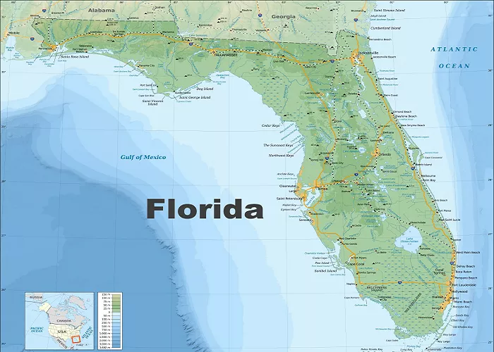
Florida, known as the Sunshine State, offers a diverse range of attractions, from its pristine beaches and vibrant cities to its rich cultural heritage and natural wonders. Whether you’re planning a visit, conducting research, or simply exploring, having an accurate and detailed map of Florida is essential. This guide explores various sources where you can obtain Florida maps, catering to different needs and preferences.
Types of Florida Maps
Before delving into where to acquire Florida maps, it’s important to understand the different types available:
- Road Maps: Ideal for navigation and trip planning, these maps detail highways, roads, and routes.
- Topographic Maps: These provide detailed information on terrain, elevation, and natural features.
- City Maps: Focused on urban areas, these maps highlight streets, landmarks, and points of interest.
- Thematic Maps: These include specialized maps showcasing demographics, climate, or tourist attractions.
Online Sources for Florida Maps
In the digital age, numerous online platforms offer a variety of Florida maps:
1. Florida Department of Transportation (FDOT)
The FDOT provides the MyFlorida Transportation Map, an interactive tool featuring detailed highways, roads, airports, cities, and tourist information. This resource is invaluable for travelers seeking up-to-date and comprehensive mapping data.
2. Visit Florida
For those interested in tourism, Visit Florida offers both the Official Florida Vacation Guide and the Official Florida State Transportation Map. These resources provide detailed maps alongside information on attractions, accommodations, and dining options. Bulk shipments are available for businesses and organizations.
3. National Geographic Maps
National Geographic’s Florida Guide Map offers unparalleled coverage, including a large road map of the entire state and detailed inset maps of major cities and metropolitan areas. Designed for travelers, this waterproof and tear-resistant map is both durable and informative.
4. Amazon
For physical maps, Amazon provides a vast selection, including laminated wall maps, county maps, and city-specific maps. For example, the “Florida Wall Map Poster with Counties” is a popular choice, offering a detailed overview suitable for classrooms and homes.
5. Walmart
Walmart offers various Florida maps both online and in-store. Options range from laminated wall maps to travel maps, catering to different preferences and needs. For instance, the “Swiftmaps Florida State Laminated Wall Map” is a popular choice among customers.
6. Freepik
For digital resources, Freepik provides free graphic resources, including Florida map vectors, stock photos, and PSD files. These are ideal for presentations, educational materials, or personal projects.
7. Vecteezy
Vecteezy offers a collection of Florida map vectors, icons, and graphics available for free download. These resources are suitable for designers, educators, and anyone needing customizable map graphics.
8. Raven Maps
Raven Maps provides fine art print maps of Florida, featuring shaded relief and elevation tints. These maps are both informative and aesthetically pleasing, suitable for display and study.
Physical Locations to Obtain Florida Maps
If you prefer physical copies or are already in Florida, consider the following options:
1. Florida Welcome Centers
Upon entering Florida, travelers can stop at Welcome Centers located along major highways. These centers provide free brochures, maps, and travel guides to assist visitors in planning their stay.
2. Local Chambers of Commerce
Local Chambers of Commerce often distribute maps highlighting regional attractions, dining, and accommodations. For example, South Florida Chamber Maps offers both print and digital maps focusing on local points of interest.
3. Tourist Information Centers
Cities and counties typically operate tourist information centers that provide free maps and guides. These resources are tailored to tourists, offering insights into local attractions and events.
4. Bookstores and Stationery Shops
Local bookstores and stationery shops often carry a selection of maps, including road atlases, city maps, and specialized guides. Visiting these stores allows you to browse and select maps that best suit your needs.
Considerations When Choosing a Map
When selecting a map, consider the following factors:
- Purpose: Are you planning a road trip, studying geography, or exploring tourist attractions?
- Detail Level: Do you need a high-level overview or intricate details of specific areas?
- Format: Would you prefer a physical map, interactive digital map, or printable version?
- Updates: Ensure the map reflects the most recent roads, developments, and changes.
Conclusion
Whether you’re navigating Florida’s extensive roadways, exploring its vibrant cities, or studying its geographical features, obtaining the right map is crucial. From official state resources like the Florida Department of Transportation to commercial options available through retailers like Amazon and Walmart, there’s a map to suit every need. Consider your specific requirements and preferences to choose the most suitable map for your Florida journey.

