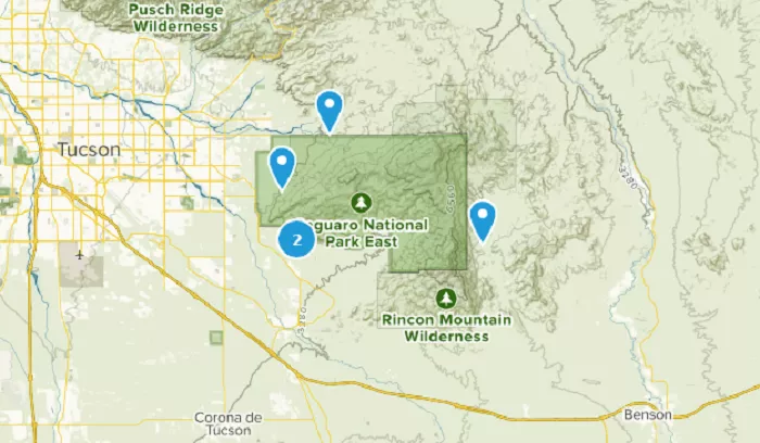
Vail, Arizona, is a small but growing community located in Pima County, in the southern part of the state. Situated approximately 24 miles (39 km) southeast of Tucson, Vail offers a unique blend of rural charm and proximity to urban amenities. Understanding its location on a map can enhance your appreciation of its geographical context and the surrounding attractions.
Vail is an unincorporated community and census-designated place (CDP) in Pima County, Arizona. As of the 2010 census, it had a population of 10,208, a significant increase from 2,484 in 2000. The area is known for its scenic landscapes, including the nearby Colossal Cave and the Rincon Mountains District of Saguaro National Park.
Geographical Location
On a map, Vail is positioned at approximately 31.9000° N latitude and 110.7000° W longitude. This places it in the southeastern region of Arizona, within Pima County. To visualize its location:
- State Map: Locate Arizona in the southwestern United States.
- County Map: Within Arizona, find Pima County, which encompasses the city of Tucson and its surrounding areas.
- Local Map: Zoom in to see Vail situated southeast of Tucson, near the intersection of Interstate 10 and Highway 83.
For a detailed visual representation, you can refer to the USGS Topo 7.5-minute map for Vail, AZ.
Pinpointing Vail on Arizona Maps
Where Vail Fits in Arizona’s Geography
Vail occupies an important transition zone between:
- The Sonoran Desert to the west
- The Rincon Mountain foothills to the north
- The high desert grasslands to the east
This positioning gives Vail unique ecological characteristics while keeping it conveniently close to Tucson’s amenities.
Distance from Key Arizona Locations
| Destination | Distance from Vail | Drive Time |
|---|---|---|
| Tucson | 20 miles | 25 minutes |
| Benson | 40 miles | 45 minutes |
| Sierra Vista | 70 miles | 1 hour 15 mins |
| Tombstone | 55 miles | 1 hour |
| Nogales (Mexico border) | 60 miles | 1 hour 10 mins |
Accessibility and Transportation
Vail’s proximity to Tucson makes it easily accessible via several major roads:
- Interstate 10 (I-10): This interstate runs east-west and passes just north of Vail, providing direct access to Tucson and other parts of Arizona.
- State Route 83 (SR 83): Running north-south, SR 83 connects Vail to Tucson to the northwest and Sonoita to the southeast.
These highways facilitate convenient travel to and from Vail, making it a desirable location for those who work or study in Tucson but prefer a quieter residential setting.
Nearby Attractions
Vail’s location offers residents and visitors access to a variety of attractions:
- Colossal Cave: A significant geological feature offering guided tours and picnic areas, located near Vail.
- Rincon Mountains District of Saguaro National Park: This area features diverse desert landscapes and hiking trails, providing opportunities to experience Arizona’s natural beauty.
Additionally, Tucson’s urban amenities, including cultural institutions, dining, and shopping, are within a short drive, offering a balance between rural tranquility and urban convenience.
Why Vail’s Location Matters
Transportation Advantages
- I-10 corridor connects Phoenix and El Paso
- Union Pacific mainline for freight
- Tucson International Airport just 30 minutes away
Ecological Importance
- Saguaro National Park boundary nearby
- Critical wildlife corridor between mountain ranges
- Unique desert-grassland transition zone
Growth Potential
- Last developable land before protected areas
- Expanding suburbs from Tucson
- New master-planned communities being built
Conclusion
Vail, Arizona, is a community that combines rural charm with accessibility to urban centers. Its location southeast of Tucson, near major highways, makes it an attractive place for those seeking a peaceful environment without being far from city amenities. Whether you’re considering a visit or a move, understanding Vail’s position on a map highlights its strategic and appealing location in southern Arizona.

