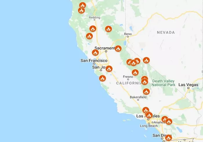
California has long been susceptible to wildfires due to its diverse landscapes, climate conditions, and vegetation types. Understanding where these fires occur is crucial for residents, policymakers, and emergency responders. Maps play a vital role in visualizing fire locations, assessing risks, and planning evacuations. This article explores the significance of fire maps in California, how they are created, and where to access them.
Importance of Fire Maps in California
Fire maps are essential tools that provide real-time information about wildfire locations, sizes, and containment statuses. They serve several critical functions:
- Public Awareness: Residents can stay informed about nearby fires, enabling timely evacuations and preparations.
- Resource Allocation: Emergency services utilize these maps to deploy resources effectively, prioritizing areas under immediate threat.
- Risk Assessment: Policymakers and planners assess fire-prone areas to implement preventive measures and land-use planning.
How Are Fire Maps Created?
Creating accurate fire maps involves integrating various data sources and technologies:
- Satellite Imagery: Satellites capture thermal anomalies indicating fire presence.
- Aerial Reconnaissance: Aircraft equipped with infrared sensors detect heat signatures from fires.
- Ground Reports: Firefighters and observers provide on-the-ground information about fire behavior and spread.
This data is processed using Geographic Information Systems (GIS) to produce detailed maps showing fire perimeters, active fronts, and affected areas.
Accessing Current Fire Maps in California
Several organizations provide up-to-date fire maps for California:
CAL FIRE
The California Department of Forestry and Fire Protection (CAL FIRE) maintains an interactive map displaying active incidents, including wildfire locations, sizes, and containment statuses. This resource is updated regularly to reflect the current situation.
San Francisco Chronicle Fire Map
The San Francisco Chronicle offers an interactive map showcasing wildfires burning across California. It provides detailed information about each fire, including its origin and impact.
AirNow Fire and Smoke Map
AirNow provides a map focusing on air quality, displaying fine particle pollution from wildfires and other sources. This tool is essential for understanding the broader environmental impact of fires.
This platform offers a live California wildfire map and tracker, helping users stay updated on active fires and related activities.
Watch Duty
Watch Duty provides real-time alerts and maps of wildfires, offering a community-driven approach to monitoring fire activity.
Understanding Fire Hazard Severity Zones
Beyond real-time fire maps, understanding areas prone to wildfires is crucial. CAL FIRE publishes Fire Hazard Severity Zone maps that categorize regions based on their fire risk. These maps consider factors like vegetation, climate, and topography to assess potential fire hazards.
Recent Developments in California Fire Mapping
Advancements in technology have enhanced the accuracy and accessibility of fire maps:
- Satellite Technology: Improved satellite imagery allows for near real-time detection of wildfires, aiding in quicker response times.
- Public Engagement: Platforms like Watch Duty enable community members to share information, fostering a collaborative approach to fire monitoring.
Conclusion
Fire maps are indispensable tools in California’s ongoing efforts to manage and mitigate wildfire risks. They provide critical information for residents, emergency responders, and policymakers, facilitating informed decisions and effective responses. Accessing and understanding these maps empowers individuals and communities to stay safe and prepared in the face of wildfire threats.

