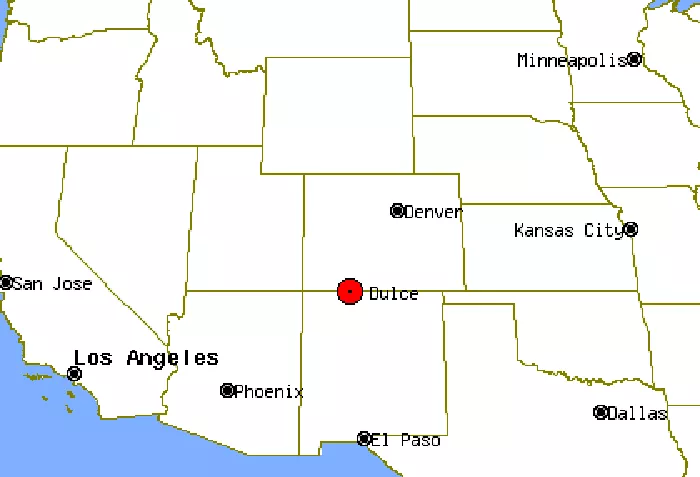
Dulce, New Mexico, is a small but fascinating town located in the southwestern United States. Known for its unique cultural heritage, stunning landscapes, and intriguing local legends, Dulce is a place worth exploring. This article will examine Dulce’s geographical location, cultural significance, economic conditions, and ecological features in detail.
Geographical Location of Dulce, New Mexico
Dulce is situated in the northern part of New Mexico, near the Colorado border. It lies within Rio Arriba County and serves as the headquarters of the Jicarilla Apache Nation.
Coordinates and Nearby Cities
-
Latitude and Longitude: Approximately 36.9336° N, 106.9989° W.
-
Elevation: About 6,837 feet (2,084 meters) above sea level.
-
Nearest Major Cities:
-
Farmington, NM – About 90 miles west.
-
Santa Fe, NM – Around 130 miles southeast.
-
Durango, CO – Roughly 100 miles northwest.
-
Topography and Landscape
Dulce is surrounded by rugged terrain, including mountains, forests, and high desert plains. The town sits near the Jicarilla Apache Reservation, which covers over 1,400 square miles of land. The area is part of the Southern Rocky Mountains, featuring:
-
Mesas and Canyons – Common in the region.
-
Forests – Dominated by ponderosa pine and juniper trees.
-
Water Sources – The Navajo River flows nearby, providing water for the community.
Climate
Dulce has a semi-arid climate with cold winters and mild summers:
-
Winter (Dec-Feb): Snow is common, with temperatures often below freezing.
-
Summer (Jun-Aug): Warm but not extremely hot, averaging around 80°F (27°C).
-
Rainfall: Limited, with most precipitation occurring in summer thunderstorms.
Cultural Significance of Dulce
Dulce is best known as the governmental center of the Jicarilla Apache Nation, a Native American tribe with deep historical roots in the region.
Jicarilla Apache Influence
-
The Jicarilla Apache people have lived in the area for centuries.
-
Their culture is rich in traditions, including hunting, weaving, and ceremonial dances.
-
The Annual Jicarilla Apache Fair (held in September) is a major event featuring rodeos, dances, and arts and crafts.
Local Legends and Mysteries
Dulce has gained attention due to conspiracy theories, particularly the “Dulce Base” legend, which claims there is a secret underground military or alien facility beneath the town. While no credible evidence supports this, the stories have attracted curiosity from outsiders.
Economic Conditions in Dulce
The economy of Dulce is primarily driven by the Jicarilla Apache Nation, with key industries including:
Tribal Enterprises
-
Casino and Tourism: The Wilderness Casino and Best Western Hotel provide jobs and attract visitors.
-
Oil and Gas Production: The Jicarilla Apache Nation manages energy resources, contributing to local revenue.
-
Timber and Ranching: Forestry and cattle ranching are traditional economic activities.
Challenges
-
Limited Job Opportunities: Many residents commute to nearby towns for work.
-
Remote Location: Distance from major cities affects business growth.
Ecology and Natural Resources
Dulce’s environment is diverse, with a mix of forests, rivers, and wildlife.
Wildlife and Conservation
-
Animals: Elk, deer, black bears, and mountain lions inhabit the area.
-
Birds: Eagles, hawks, and turkeys are common.
-
Protected Areas: Parts of the Jicarilla Apache land are managed for conservation.
Environmental Concerns
-
Drought: Water scarcity can be an issue.
-
Forest Fires: Dry conditions increase wildfire risks.
Conclusion
Dulce, New Mexico, is a unique town with a rich cultural heritage, striking landscapes, and an economy shaped by tribal enterprises. While remote, its natural beauty and Apache traditions make it a notable location in the American Southwest. Whether you’re interested in Native American culture, outdoor adventures, or local legends, Dulce offers a fascinating glimpse into life in northern New Mexico.

