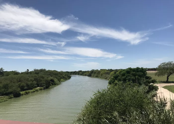
The Rio Grande, known as the Río Bravo del Norte in Mexico, is the river that forms the natural boundary between the U.S. state of Texas and Mexico. Stretching approximately 1,896 miles (3,051 kilometers), it is one of the longest rivers in North America. Originating in the San Juan Mountains of Colorado, the Rio Grande flows through New Mexico and along the Texas-Mexico border before emptying into the Gulf of Mexico.
Geography of the Rio Grande
The Rio Grande (called Río Bravo del Norte in Mexico) is one of the longest rivers in North America. It flows 1,896 miles from the Rocky Mountains in Colorado to the Gulf of Mexico.
The Rio Grande as the Texas-Mexico Border
Where Does the Border Start and End?
- Starting Point: Near El Paso, Texas, and Ciudad Juárez, Mexico.
- Ending Point: At the Gulf of Mexico, near Brownsville, Texas, and Matamoros, Mexico.
How Long Is the Border?
The Rio Grande forms about 1,254 miles of the 1,954-mile U.S.-Mexico border. The rest is marked by fences and deserts.
Key Sections of the Border
| Region | Major Cities (U.S.) | Major Cities (Mexico) |
|---|---|---|
| Upper Rio Grande | El Paso | Ciudad Juárez |
| Big Bend Area | Presidio | Ojinaga |
| Lower Rio Grande | Laredo, McAllen, Brownsville | Nuevo Laredo, Reynosa, Matamoros |
Historical Significance
The Treaty of Guadalupe Hidalgo (1848)
After the Mexican-American War (1846–1848), the U.S. and Mexico signed this treaty. It officially made the Rio Grande the border between Texas and Mexico.
The Gadsden Purchase (1853)
A small part of the border near Arizona was adjusted, but the Rio Grande remained the main divider.
Border Disputes
- Chamizal Conflict (1911–1963): The river shifted near El Paso, causing land disputes. The U.S. and Mexico later fixed the boundary.
- Modern Border Security: Today, the Rio Grande is a focal point for immigration and drug enforcement.
Major Cities Along the Rio Grande
Texas Side
- El Paso – The largest city on the border, opposite Ciudad Juárez.
- Laredo – A major trade hub with Nuevo Laredo, Mexico.
- McAllen & Brownsville – Key cities in the Rio Grande Valley.
Mexico Side
- Ciudad Juárez – One of Mexico’s largest cities.
- Nuevo Laredo – A major freight crossing into Texas.
- Reynosa & Matamoros – Important industrial and trade centers.
Ecological Importance
Beyond its geopolitical significance, the Rio Grande is vital ecologically. It supports a range of ecosystems, providing habitats for numerous plant and animal species. The river’s waters irrigate agricultural lands and supply drinking water to communities on both sides of the border. However, the river faces challenges such as reduced flow due to over-extraction and prolonged droughts, impacting its health and the communities that rely on it.
Cultural and Economic Impact
The Rio Grande is deeply embedded in the cultural fabric of the border regions. It has influenced local traditions, music, and folklore. Economically, the river supports agriculture, especially in the Lower Rio Grande Valley, known for its citrus fruits and vegetables. Additionally, it facilitates trade and commerce between the U.S. and Mexico, with several border crossings situated along its course.
Environmental Challenges
Water Shortages
- The Rio Grande is overused for farming and cities.
- Climate change is reducing snowmelt from the Rockies, lowering river levels.
Pollution
- Factories and farms on both sides contribute to chemical runoff.
- Some areas have unsafe water quality.
Wildlife Impact
- Endangered species like the Rio Grande silvery minnow struggle to survive.
- Dams and water diversions disrupt fish migration.
Conclusion
The Rio Grande serves as more than just a boundary between Texas and Mexico; it is a lifeline that nurtures ecosystems, supports economies, and shapes cultures. Understanding its significance is crucial for fostering cooperation and ensuring the sustainable management of this vital resource.

