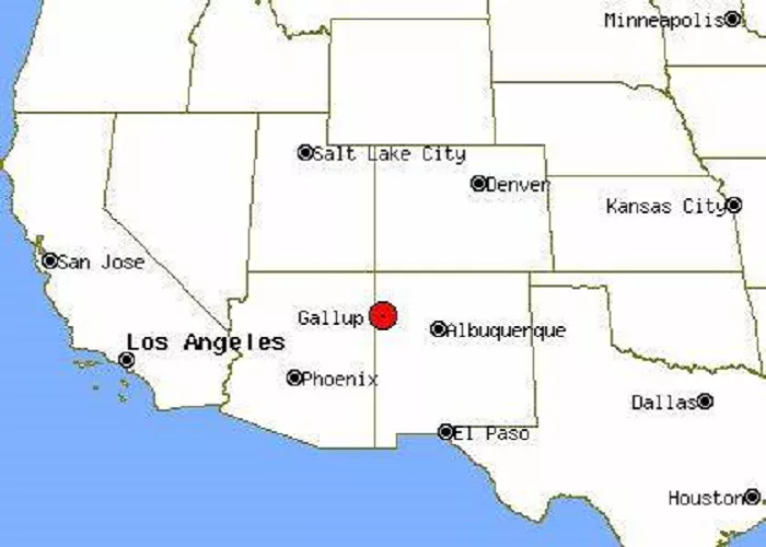
Gallup is a city located in northwestern New Mexico, serving as the county seat of McKinley County. Renowned for its rich Native American heritage and as a historic stop along Route 66, Gallup holds a unique place in American history. This article delves into Gallup’s geographical location, historical significance, cultural importance, and provides detailed maps to enhance your understanding of this fascinating city.
Gallup’s Exact Location on the Map
To find Gallup on a map, follow these steps:
- Look at a map of the United States – Find the southwestern region.
- Locate New Mexico – It’s between Arizona (west), Colorado (north), Texas (east), and Mexico (south).
- Find the northwestern part of New Mexico – Gallup is near the Arizona border.
- Check along Interstate 40 (I-40) – Gallup is right off this major highway.
Geographic Coordinates of Gallup
- Latitude: 35.5281° N
- Longitude: 108.7426° W
- Elevation: 6,512 feet (1,985 meters) above sea level
Nearby Cities and Landmarks
- Flagstaff, Arizona – About 180 miles west
- Albuquerque, New Mexico – About 140 miles southeast
- Window Rock, Arizona – About 25 miles west (Navajo Nation capital)
- Zuni Pueblo – About 35 miles south
Historical Significance
Established in 1880 as a railroad town, Gallup was named after David L. Gallup, a paymaster for the Atlantic and Pacific Railroad. The city’s strategic location made it a vital hub for trade and transportation. Over time, Gallup developed a rich cultural tapestry, influenced by the diverse Native American tribes in the region.
Cultural Importance
Often referred to as the “Heart of Indian Country,” Gallup boasts a significant Native American population, with residents from tribes such as the Navajo, Hopi, and Zuni. The city celebrates its heritage through various events, notably the annual Inter-Tribal Indian Ceremonial, which showcases traditional dance, music, and crafts.
Maps of Gallup, New Mexico
To provide a clearer understanding of Gallup’s location and layout, here are some detailed maps:
1. Gallup City Map
This map offers an overview of Gallup’s streets, landmarks, and surrounding areas.
2. Gallup Area Map
This map highlights Gallup’s position within McKinley County and its proximity to neighboring regions.
3. Gallup Satellite Map
For a bird’s-eye view, this satellite image provides a detailed look at Gallup’s terrain and urban development.
Nearby Attractions
Gallup’s location offers access to several notable attractions:
- Red Rock Park: Located just east of Gallup, this park features striking red sandstone formations and offers hiking trails with panoramic views.
- Historic Route 66: Gallup’s downtown area is a testament to its Route 66 heritage, with numerous murals and historic buildings reflecting the city’s past.
- Navajo Nation: As a gateway to the Navajo Nation, Gallup provides cultural experiences and access to significant sites like Monument Valley and Canyon de Chelly.
Conclusion
Gallup, New Mexico, is a city rich in history and culture, strategically located in the heart of the American Southwest. Its unique blend of Native American heritage, historical significance, and geographical positioning makes it a noteworthy destination for travelers and scholars alike. The provided maps and information aim to offer a comprehensive understanding of Gallup’s place on the map, both literally and figuratively.

