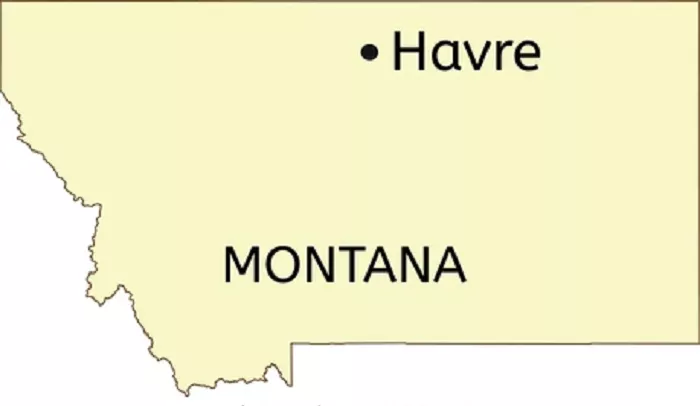
Havre, Montana, is a city rich in history and culture, serving as the county seat of Hill County. Located in the northern part of the state, Havre plays a significant role in the region’s economy and community life. Understanding its geographical location enhances one’s appreciation of its historical importance and the role it plays in Montana’s landscape.
Locating Havre on a Map
1. Geographic Coordinates
Havre is situated at approximately 48.5453° N latitude and 109.6775° W longitude. These coordinates place the city in the north-central region of Montana, offering a precise reference for mapping and navigation purposes.
2. Position Within Montana
On a map of Montana, Havre is located in the north-central part of the state. It lies along U.S. Highway 2, which runs east-west across the northern tier of the United States. This positioning places Havre approximately:
- North of Great Falls: About 110 miles (177 kilometers) north.
- South of the Canadian Border: Approximately 65 miles (105 kilometers) south.
- East of the Rocky Mountains: Roughly 200 miles (322 kilometers) east.
3. Nearby Cities and Landmarks
Havre’s location is further contextualized by its proximity to several notable cities and landmarks:
- To the West: The city of Shelby, Montana, is about 90 miles (145 kilometers) to the west, serving as a gateway to the Canadian border.
- To the East: The city of Glasgow is approximately 100 miles (161 kilometers) east, offering additional cultural and economic connections.
- To the North: The Canadian border is roughly 65 miles (105 kilometers) north, with the nearest border crossing located near the town of Coutts, Alberta.
- To the South: The city of Billings is about 300 miles (483 kilometers) south, providing access to larger urban amenities.
4. Transportation Routes
Havre’s accessibility is facilitated by several key transportation routes:
- U.S. Highway 2: This major east-west highway connects Havre to cities like Great Falls to the south and Glasgow to the east, making it a vital corridor for commerce and travel.
- Interstate 15: Located to the west of Havre, this interstate connects cities like Helena and Butte, further enhancing the city’s connectivity.
- Burlington Northern Santa Fe (BNSF) Railway: Havre serves as a significant railroad hub, with the BNSF Railway operating extensive rail yards and facilities in the city, underscoring its historical and ongoing importance as a transportation center.
5. Topographical Features
The terrain surrounding Havre is characterized by:
- Plains and Prairies: The area features expansive plains, ideal for agriculture, particularly wheat farming.
- Milk River: Flowing to the north of Havre, the Milk River provides water resources and recreational opportunities, contributing to the region’s ecological diversity.
- Bear Paw Mountains: Located to the south of the city, these mountains offer historical significance as the site of the Nez Perce War’s final battle.
Historical Context
Established in 1891, Havre was named after Le Havre, France, reflecting the influence of French settlers in the area. The city developed rapidly due to its strategic location as a railroad hub, with the Great Northern Railway playing a pivotal role in its growth. This railway connection facilitated commerce and movement, linking Havre to national markets and contributing to its economic prosperity.
Cultural Significance
Havre’s cultural landscape is enriched by institutions such as:
- Havre Beneath the Streets: An underground museum offering insights into the city’s history, including its Prohibition-era past and the impact of the railroad on its development.
- Blaine County Museum: Located nearby in Chinook, this museum showcases regional history, including Native American artifacts and pioneer exhibits.
- Fort Belknap Indian Reservation: Situated to the south of Havre, this reservation is home to the Gros Ventre and Assiniboine tribes, offering cultural experiences and insights into Native American heritage.
Economic Importance
Havre serves as a commercial center for the surrounding agricultural region, providing services and support to local farmers and ranchers. Its role as a transportation hub, with both rail and highway connections, further bolsters its economic significance. The city hosts various annual events, such as the Havre Festival Days, celebrating local culture, music, and community spirit.
Conclusion
Havre, Montana, is strategically located in the north-central part of the state, offering a unique blend of historical depth, cultural richness, and economic vitality. Its position on the map is not just a point of reference but a gateway to understanding the broader narratives of American expansion, indigenous history, and the development of the American West. Whether approached from the east, west, north, or south, Havre stands as a testament to the enduring spirit and diverse heritage of Montana.

