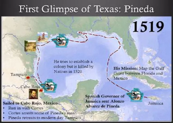
In 1519, Spanish explorer and cartographer Alonso Álvarez de Pineda became the first European to map the coastline of Texas. His expedition provided valuable insights into the Gulf of Mexico’s northern coast, significantly enhancing European understanding of the region’s geography.
Early Exploration of the Gulf Coast
Before Pineda’s voyage, the Gulf of Mexico’s coastline remained largely uncharted by Europeans. In 1517, Francisco Hernández de Córdoba’s expedition reached the Yucatán Peninsula, encountering a sophisticated civilization. This discovery piqued Spain’s interest, leading to further expeditions. In 1518, Juan de Grijalva explored the Gulf coast from the Yucatán to the Pánuco River, near present-day Tampico, Mexico, observing a substantial native population along the riverbanks.
Alonso Álvarez de Pineda’s Expedition
Motivated by previous discoveries, Francisco de Garay, the governor of Jamaica, commissioned Alonso Álvarez de Pineda in 1519 to chart the Gulf’s western coastline. Pineda set sail with three ships and approximately 270 men, navigating from Jamaica through the Yucatán Channel between Cuba and the mainland. He first landed on the Florida panhandle, then sailed eastward around Florida’s cape, and subsequently westward along the Gulf coast. On June 2, Pineda discovered the Mississippi River, naming it “Espíritu Santo” due to its Pentecost discovery.
The Lasting Impact of Pineda’s Expedition
1. Spain’s Claim to Texas
- Pineda’s voyage strengthened Spain’s territorial claims.
- Led to future Spanish colonization in the 1700s.
2. Influence on Future Explorers
- Hernán Cortés referenced Pineda’s maps in his conquest of Mexico.
- Cabeza de Vaca’s disastrous 1528 expedition followed similar routes.
3. The Name “Amichel”
- Pineda called the region “Amichel” (now forgotten).
- Later, the area became known as “Tejas” (from the Caddo word for “friends”).
Mapping the Texas Coastline
Pineda’s expedition continued westward along the Texas coast. His map, the earliest known depiction of Texas, illustrates the coast from Florida to the Yucatán with remarkable accuracy for its time. The map identifies three bays or inlets along the Texas coast, likely corresponding to present-day Galveston Bay, Matagorda Bay, and Corpus Christi Bay. Notably, the map does not assign names to specific geographic features, reflecting the preliminary nature of European exploration in the area.
Significance of Pineda’s Map
Pineda’s map holds historical importance as the first European representation of the Gulf Coast region that is now part of the United States. It dispels earlier misconceptions, such as the belief in a sea passage to Asia and the notion that Florida was an island. The map also provides evidence of Pineda’s interactions with native populations, including the Karankawa Indians, known for their notable height, inspiring the “Land of Giants” designation on later maps.
Debunking Myths
Over time, certain myths have emerged regarding Pineda’s exploration. One such myth suggests that he named Corpus Christi Bay after the feast day of Corpus Christi. However, historical records indicate that the earliest known reference to Corpus Christi Bay by that name dates to 1766, not 1519. Additionally, claims that Pineda explored the Rio Grande lack historical evidence, as reports from the time clearly identify the river he explored as the Pánuco.
Conclusion
Alonso Álvarez de Pineda’s 1519 expedition marked a pivotal moment in the European exploration of the Gulf of Mexico’s northern coast. His map provided the first European depiction of the Texas coastline, offering insights that would influence subsequent explorations and settlements in the region. While some myths have arisen surrounding his journey, the historical evidence underscores Pineda’s role as the first European to chart Texas’s coastline, laying the groundwork for future exploration and understanding of the area.

