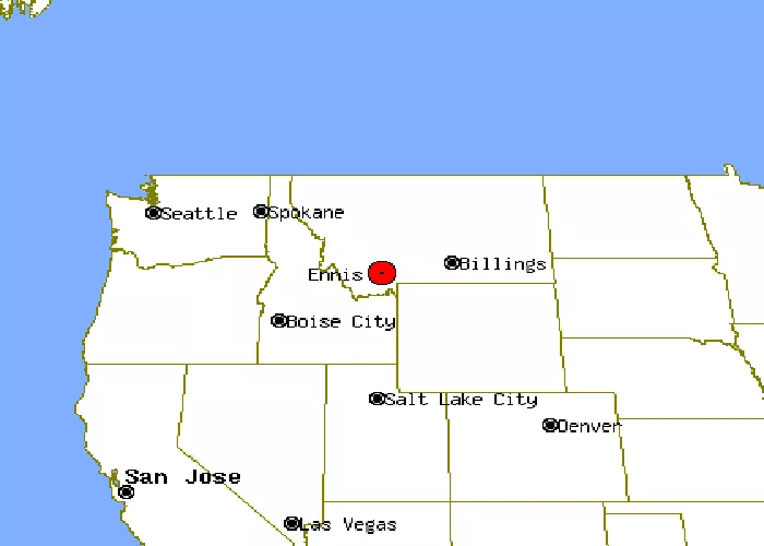
Ennis is a charming town located in the southwestern part of Montana, USA. Nestled within Madison County, it serves as a gateway to some of the state’s most picturesque landscapes and outdoor recreational opportunities. Understanding its location is essential for travelers seeking to explore this region’s natural beauty and cultural heritage.
Geographic Location of Ennis, Montana
Ennis lies in the heart of the Madison River Valley, surrounded by three prominent mountain ranges:
- Madison Range: Located to the east of Ennis, this range offers stunning vistas and serves as a backdrop to the town.
- Gravelly Range: Situated to the south, these mountains provide ample opportunities for hiking and wildlife observation.
- Tobacco Root Mountains: Found to the northwest, this range adds to the scenic beauty encompassing Ennis.
The town is positioned along U.S. Highway 287, which follows the Madison River as it descends from West Yellowstone. This strategic location makes Ennis a convenient stop for travelers exploring the region.
Proximity to Major Cities and Landmarks
Ennis’s location offers easy access to several notable destinations:
- Bozeman, Montana: Approximately 60 miles northeast of Ennis, Bozeman is a vibrant city known for its cultural attractions and Montana State University.
- West Yellowstone: Located about 70 miles southeast, this town serves as a primary gateway to Yellowstone National Park, one of the nation’s most renowned natural reserves.
- Virginia City: Just 14 miles west of Ennis, Virginia City is a well-preserved ghost town that offers a glimpse into Montana’s gold rush era.
These proximities make Ennis an ideal base for exploring southwestern Montana’s rich history and natural wonders.
Access Routes to Ennis
Travelers can reach Ennis via several routes:
- From Bozeman: Take U.S. Highway 191 south to Four Corners, then head west on U.S. Highway 287 directly into Ennis.
- From West Yellowstone: Travel north on U.S. Highway 287, which leads directly to Ennis, following the scenic Madison River.
- From Virginia City: A short drive east on Montana Highway 287 brings you to Ennis, making it a convenient excursion for those exploring historic sites.
These well-maintained highways ensure that Ennis is accessible year-round, offering travelers smooth journeys through Montana’s picturesque landscapes.
Ennis’s Natural Surroundings
The town’s location is enriched by various natural features:
- Madison River: Flowing along the eastern border of Ennis, this river is renowned for its blue-ribbon trout fishing, attracting anglers from around the world.
- Ennis Lake: Situated just downstream from the town, this lake was formed by the Madison Dam and offers recreational activities such as boating and fishing.
These natural attractions contribute to Ennis’s reputation as a hub for outdoor enthusiasts seeking fishing, hiking, and wildlife viewing opportunities.
Historical Context of Ennis’s Location
The area around Ennis has a rich history:
- Indigenous Presence: Before European settlement, the Shoshone, Flathead, and Bannock tribes hunted in the Madison Valley each spring, drawn by its abundant resources.
- Lewis and Clark Expedition: In July 1805, the famed expedition viewed the Madison Valley from Three Forks, marking one of the early recorded observations of the area by European explorers.
- Gold Rush Era: The discovery of gold in Alder Gulch in 1863 led to a rush of settlers. Shortly thereafter, William Ennis homesteaded along the Madison River, establishing the foundation for the town that bears his name.
This historical backdrop adds depth to Ennis’s identity, blending cultural heritage with its scenic environment.
Ennis on Contemporary Maps
On modern maps, Ennis is easily identifiable:
- Coordinates: The town is located at approximately 45.3494° N latitude and 111.7319° W longitude.
- Elevation: Ennis sits at an elevation of about 4,941 feet (1,506 meters) above sea level, contributing to its crisp mountain air and panoramic views.
These geographical markers assist travelers in pinpointing Ennis’s location and planning their visits accordingly.
Visualizing Ennis’s Location
To better understand Ennis’s placement within Montana:
- State Context: On a map of Montana, locate Madison County in the southwestern region; Ennis is centrally positioned within this county.
- Regional Context: Identify the convergence of the Madison, Gravelly, and Tobacco Root mountain ranges, with the Madison River running nearby; Ennis lies at this intersection.
Utilizing online mapping services or GPS devices can provide interactive and detailed views, enhancing your familiarity with the area.
Conclusion
Ennis, Montana, is a town rich in natural beauty and historical significance. Positioned in the Madison River Valley and surrounded by majestic mountain ranges, it serves as a focal point for outdoor recreation and cultural exploration. Whether you’re an angler seeking renowned fishing spots, a history enthusiast exploring Montana’s past, or a traveler appreciating scenic landscapes, Ennis offers a welcoming destination. Its accessible location via major highways and proximity to notable cities and landmarks make it an ideal stop on any Montana itinerary.

