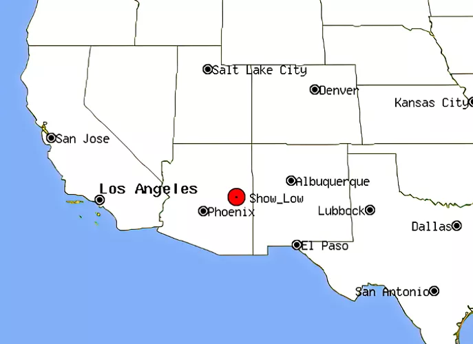
Show Low is a city located in northeastern Arizona, United States. Nestled in the heart of the White Mountains, it offers a unique blend of natural beauty, recreational opportunities, and a rich history. Understanding Show Low’s geographical location provides insight into its accessibility and the attractions it offers.
Geographical Location
Show Low is situated in the White Mountains region of Arizona. To find it on a map, look for the eastern part of the state, near the border with New Mexico. Specifically, Show Low is located at approximately 34.2542° N latitude and 110.0298° W longitude. It’s about 180 miles (290 kilometers) northeast of Phoenix, the state capital, and roughly 160 miles (257 kilometers) southeast of Flagstaff.
Nearby Cities and Landmarks
To give you a better sense of where Show Low is, here are some nearby cities and landmarks:
- Pinetop-Lakeside: Just 7 miles (11 kilometers) to the east, this neighboring town is often considered part of the same community as Show Low.
- Springerville: Located about 50 miles (80 kilometers) to the east, Springerville is another small town in the White Mountains region.
- Apache-Sitgreaves National Forests: These forests surround Show Low and offer numerous recreational opportunities, including hiking, fishing, and camping.
- Petrified Forest National Park: About 100 miles (161 kilometers) to the northwest, this park is known for its fossilized wood and colorful badlands.
Accessibility and Transportation
The city serves as a central hub in the White Mountains region, with several major highways converging in the area:
- Arizona State Route 260: This highway connects Show Low to Payson and other central Arizona communities, facilitating east-west travel.
- Arizona State Route 60: Running through Show Low, SR 60 links the city to Globe and the eastern towns of Eagar and Springerville, supporting regional connectivity.
- Arizona State Route 77: This route connects Show Low to Tucson in the south and to Holbrook in the north, enhancing north-south travel.
Additionally, Show Low is accessible via Interstate 40 to the north, providing east-west access across the state. The Show Low Regional Airport, located approximately two miles east of downtown, offers commuter air services, enhancing the city’s connectivity.
Nearby Landmarks and Attractions
The city’s location in the White Mountains region places it near several notable natural and recreational sites:
- Fool Hollow Lake Recreation Area: A popular destination for camping, fishing, and hiking, offering picturesque views and a tranquil escape into nature.
- Pinetop-Lakeside: Located nearby, this area boasts the world’s largest stand of Ponderosa Pines, providing year-round recreational opportunities and stunning scenery.
- Sunrise Ski Resort: Situated northeast of Show Low, this resort offers skiing and snowboarding during the winter months, attracting visitors seeking winter sports.
The History of Show Low
Understanding the history of Show Low can give you a deeper appreciation for its unique location. The city’s name comes from a legendary poker game between two settlers, Marion Clark and Corydon Cooley. The story goes that they couldn’t agree on who should leave the area, so they decided to let a game of cards decide. Cooley reportedly said, “If you can show low, you win.” Clark drew the deuce of clubs (the lowest possible card) and won the game, hence the name “Show Low.”
1. Early Settlement
Show Low was originally a small settlement in the late 19th century. It grew slowly but steadily, thanks to its strategic location along major trade routes. The arrival of the railroad in the early 20th century further boosted its growth, making it a hub for logging and ranching.
2. Modern Development
Today, Show Low is a thriving community with a population of around 11,000 people. It’s known for its friendly atmosphere, outdoor activities, and scenic beauty. The city has also become a popular destination for retirees and tourists looking to escape the heat of Arizona’s lower elevations.
Climate and Environment
Show Low experiences a mild four-season climate, with summer temperatures generally 25 degrees cooler than those in Phoenix and Tucson. Situated atop the Mogollon Rim, the city is surrounded by extensive forests, making it a popular recreational area for outdoor enthusiasts.
Conclusion
Show Low, Arizona, is strategically located in the northeastern part of the state, offering easy access to major highways and proximity to natural wonders. Its rich history, cultural significance, and recreational opportunities make it a unique and inviting destination for residents and visitors alike.

