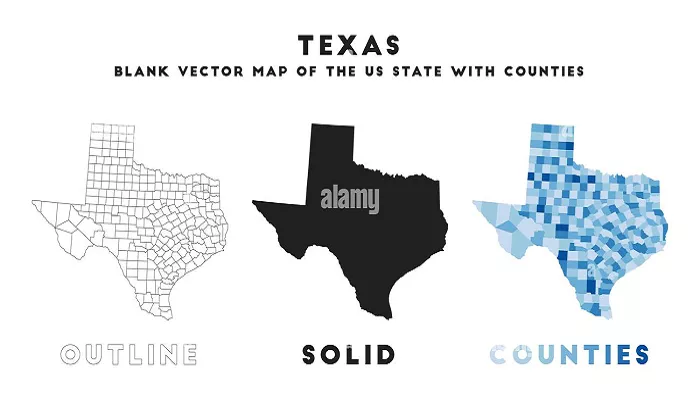
Texas, the second-largest state in the United States, is renowned for its vast landscapes and distinctive shape. A notable feature of Texas’s geography is its straight-line borders, particularly along its western edge. Understanding the reasons behind these straight borders requires a journey through history, geography, and political negotiations.
The Formation of Texas’s Borders
The Republic of Texas (1836-1845)
In 1836, Texas declared its independence from Mexico, establishing the Republic of Texas. The new republic claimed boundaries that extended to the Rio Grande in the southwest and west, encompassing parts of present-day New Mexico, Colorado, and Wyoming. These expansive claims were based on interpretations of territorial boundaries but were not universally recognized.
U.S. Annexation and Boundary Disputes
When Texas was annexed by the United States in 1845, its claimed boundaries led to disputes, particularly with Mexico, which did not recognize Texas’s independence or its proposed borders. The disagreement over the southern boundary—whether it was the Nueces River or the Rio Grande—was a significant factor leading to the Mexican-American War (1846-1848).
The Compromise of 1850
Following the Mexican-American War, the Treaty of Guadalupe Hidalgo (1848) established the Rio Grande as the border between Texas and Mexico. However, Texas’s claims to territories extending into present-day New Mexico and beyond remained contentious. The Compromise of 1850, a series of congressional acts, sought to resolve these disputes. As part of the compromise, Texas relinquished its claims to lands extending into modern-day New Mexico, Colorado, Oklahoma, and Kansas in exchange for $10 million to pay off its national debt. This agreement established the straight-line borders we see today, particularly the western boundary along the 103rd meridian west.
The Role of Geopolitical Negotiations
The establishment of straight borders was common in the 19th century, as it simplified territorial delineations and reduced the potential for disputes. Natural boundaries like rivers can shift over time, leading to complications, whereas straight lines based on longitudinal and latitudinal markers provide clear, unchanging demarcations. In the case of Texas, the use of the 103rd meridian west as a boundary was a practical solution resulting from negotiations to balance interests between the federal government and the state.
The Impact of Natural Features
While Texas’ northern and western borders are straight, its eastern and southern borders follow natural features:
- Eastern Border: The border with Louisiana and Arkansas follows the Sabine River and the Red River, which were used as natural boundaries.
- Southern Border: The border with Mexico is defined by the Rio Grande, a major river that has been a key geographical and political feature for centuries.
These curved borders reflect the influence of geography on boundary-making.
The Significance of Straight Borders
Straight borders have had a lasting impact on Texas:
- Political Stability: Clear, straight borders helped reduce conflicts over land and resources.
- Economic Development: Defined borders made it easier to survey and distribute land, encouraging settlement and economic growth.
- Cultural Identity: Texas’ unique shape has become a symbol of its independence and pride.
Fun Facts About Texas’ Borders
- The “Panhandle”: Texas’ northernmost region is called the Panhandle because of its narrow, rectangular shape.
- Four Corners: Texas is one of only three states (along with Hawaii and Alaska) that does not share a border with any other U.S. state at a single point.
- Border Disputes: Even after the Compromise of 1850, small border disputes continued for decades, particularly along the Rio Grande.
Conclusion
The straight borders of Texas are the result of historical claims, international conflicts, and political compromises. These borders, established through treaties and legislative acts, reflect a period when the young United States was expanding westward, and clear territorial boundaries were essential for governance and development. Understanding this history provides insight into how the distinctive shape of Texas came to be and highlights the complex interplay between geography and politics in the formation of state boundaries.

