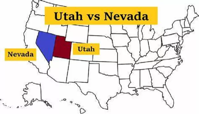
Utah and Nevada are two neighboring states in the western United States, each offering unique geographical features and cultural significance. Understanding their maps provides insight into their landscapes, infrastructure, and regional relationships.
Overview of Utah and Nevada on the Map
Utah and Nevada are located in the western part of the United States. They are part of the region known as the Intermountain West, which is characterized by mountain ranges, deserts, and plateaus. Both states are landlocked, meaning they do not border any ocean. However, they are rich in natural wonders and man-made landmarks.
- Utah is known for its stunning national parks, including Zion, Bryce Canyon, and Arches. It is also famous for the Great Salt Lake, which is the largest saltwater lake in the Western Hemisphere.
- Nevada is home to the bustling city of Las Vegas, the vast Mojave Desert, and Lake Tahoe, a freshwater lake shared with California. It is also the driest state in the U.S., with much of its land covered by desert.
On the map, Utah is located to the east of Nevada. The two states share a border that runs north to south, stretching approximately 267 miles. This border is defined by longitude 114°W in the south and longitude 115°W in the north.
Detailed Maps of Utah and Nevada
For a comprehensive understanding of these states’ layouts, detailed maps are invaluable. Here are some resources:
- Nevada State Highway Map: The Nevada Department of Transportation offers an official highway map that highlights major roads, highways, and points of interest within the state. This map is essential for travelers and those interested in Nevada’s infrastructure.
- County Map of Utah and Nevada: Historical maps, such as the 1867 county map by Samuel Augustus Mitchell, provide insights into the administrative divisions and territorial changes over time. These maps are valuable for historical research and understanding the evolution of state boundaries.
Transportation Networks
Both Utah and Nevada are traversed by an extensive network of highways and roads, facilitating travel and commerce. Key routes include:
- Interstate Highways: Interstate 15 (I-15) runs north-south through Utah, connecting cities like Salt Lake City and St. George. In Nevada, I-15 continues southward, passing through Las Vegas.
- U.S. Highways: Routes such as U.S. Highway 50, known as the “Loneliest Road in America,” stretch across Nevada, offering scenic drives through remote landscapes.
Topographical Features
The topography of Utah and Nevada is diverse:
- Utah: Features such as the Wasatch Mountains, the Great Salt Lake, and the red rock formations of southern Utah are prominent.
- Nevada: The Sierra Nevada mountains form the western border, while the eastern part consists of vast desert basins and mountain ranges.
Cultural and Historical Significance
Both states have rich histories:
- Utah: Home to Native American tribes like the Navajo and Ute, Utah also has a significant Mormon heritage, with Salt Lake City being the headquarters of the Church of Jesus Christ of Latter-day Saints.
- Nevada: Known for the Comstock Lode silver discovery, Nevada’s history is intertwined with mining. Las Vegas, in particular, has become synonymous with entertainment and tourism.
Economic and Recreational Aspects
Economically, both states benefit from:
- Utah: Tourism related to national parks, skiing, and outdoor activities contributes significantly to the economy.
- Nevada: Beyond its entertainment industry, Nevada’s economy includes mining and, more recently, technology sectors.
Recreationally, both states offer:
- National Parks: Utah boasts five national parks, known as the “Mighty Five,” while Nevada offers unique sites like Great Basin National Park.
- Outdoor Activities: From skiing in Utah’s mountains to hiking Nevada’s deserts, outdoor enthusiasts have ample opportunities.
Conclusion
Maps of Utah and Nevada reveal the complexity and beauty of these western states. From their varied terrains to their rich histories and economies, understanding their geographical layouts enhances our appreciation of their unique contributions to the United States.

