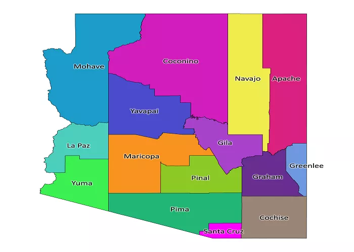
Arizona, often referred to as “The Grand Canyon State,” is a landlocked state located in the southwestern region of the United States. Understanding Arizona’s position on a U.S. map involves exploring its geographical boundaries, neighboring states, and significant geographical features.
Geographical Location and Borders
Arizona shares borders with six other states and one country:
- Utah: Located to the north of Arizona.
- Colorado: Situated to the northeast, where Arizona, Colorado, New Mexico, and Utah meet at the Four Corners.
- New Mexico: Found to the east of Arizona.
- Texas: Located to the southeast, sharing a border with Arizona.
- Sonora (Mexico): Arizona shares a southern border with the Mexican state of Sonora.
- Baja California (Mexico): To the southwest, Arizona borders the Mexican state of Baja California.
- California: Situated to the west of Arizona.
This unique positioning allows Arizona to be part of the Four Corners region, where four states meet at a single point.
Major Geographical Regions within Arizona
Arizona’s diverse landscape can be divided into several distinct geographical regions:
Colorado Plateau
The Colorado Plateau is a semi-arid, mostly flat-lying region ranging from 5,000 to 8,000 feet (1,524 to 2,438 meters) in elevation, centered on the Four Corners region. It encompasses northern Arizona, except for a small portion of northwestern Arizona. The Plateau ends with the steep rock wall of the Mogollon Rim, which defines its southern edge. This region is known for its brightly colored sedimentary rock formations and natural features such as the Grand Canyon, Antelope Canyon, Meteor Crater, Painted Desert, and the Petrified Forest.
Transition Zone
The Transition Zone is a northwest-trending escarpment of mountainous terrain in central Arizona, shaped by the intersection of the higher-level Colorado Plateau with the lower-level Basin and Range Province. This area consists of a series of rugged mountain ranges and valleys, including the Mazatzal, Santa Maria, Sierra Ancha, and White mountain ranges. The Transition Zone experiences a variation in temperature by altitude and tends to receive heavier rainfall due to its mountainous terrain.
Basin and Range Province
The Basin and Range Province occupies the southern part of Arizona, characterized by steep, linear mountain ranges alternating with lengthy deserts. The mountain ranges can rise above 9,000 feet, creating biological islands inhabited by cool-climate plants and animals. This region supplies nearly all of the copper mined in Arizona and contains other minerals such as gold, silver, and barite.
Major Cities and Urban Areas
Arizona’s largest city and capital is Phoenix, located in the central part of the state. Other significant cities include:
- Tucson: Situated in the southern part of the state.
- Mesa: Located near Phoenix in the central region.
- Chandler: Also near Phoenix, in the central region.
- Scottsdale: Adjacent to Phoenix in the central region.
These cities contribute to Arizona’s cultural and economic significance.
Neighboring Regions and States
Arizona’s location places it in close proximity to several other U.S. states and Mexican regions:
- Utah: Located to the north of Arizona.
- Colorado: Situated to the northeast, where Arizona, Colorado, New Mexico, and Utah meet at the Four Corners.
- New Mexico: Found to the east of Arizona.
- Texas: Located to the southeast, sharing a border with Arizona.
- Sonora (Mexico): Arizona shares a southern border with the Mexican state of Sonora.
- Baja California (Mexico): To the southwest, Arizona borders the Mexican state of Baja California.
- California: Situated to the west of Arizona.
This strategic location contributes to Arizona’s unique cultural and economic interactions with its neighbors.
Conclusion
On a U.S. map, Arizona is positioned in the southwestern quadrant, bordered by Utah, Colorado, New Mexico, Texas, Sonora, Baja California, and California. Its diverse geography, ranging from deserts to mountains, and its strategic location make it a unique and integral part of the United States.

