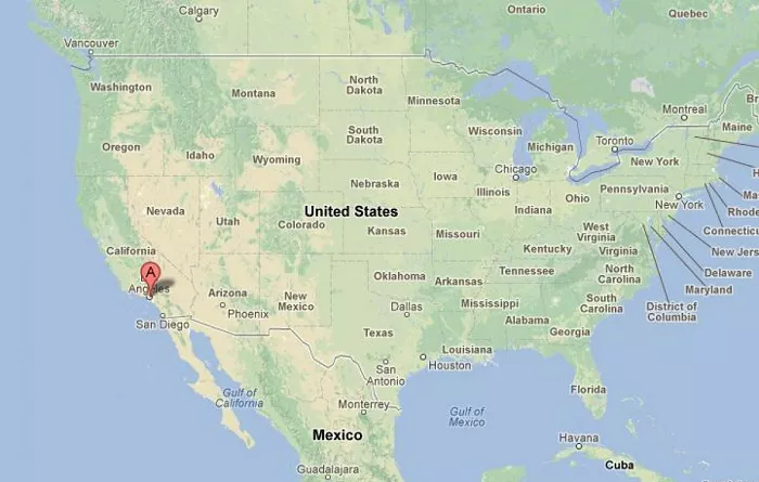
Los Angeles, commonly known as LA, is a major city located in Southern California. Situated along the Pacific Ocean, it serves as a cultural, financial, and commercial hub.
Understanding the geographical location of Los Angeles is essential for grasping its significance within California. The city is renowned for its diverse culture, thriving entertainment industry, and as a gateway between the United States and the Pacific Rim.
Geographical Location
Los Angeles is positioned in the southern part of California, along the coast of the Pacific Ocean. It lies approximately between latitudes 33.7° N and 34.3° N, and longitudes 118.2° W and 118.7° W. This places LA about 120 miles north of the U.S.-Mexico border and approximately 380 miles south of San Francisco.
Surrounding Geography
- To the West: The city borders the Pacific Ocean, providing extensive beachfronts and a harbor.
- To the North: It is bordered by the San Fernando Valley and the Santa Clarita Valley, leading into the mountainous regions of the Angeles National Forest.
- To the East: Los Angeles extends towards the Inland Empire, encompassing areas like East Los Angeles and the San Gabriel Valley.
- To the South: The city meets the Pacific Ocean and extends towards the Palos Verdes Peninsula.
City Layout
Los Angeles is characterized by its sprawling urban landscape, encompassing a variety of neighborhoods, each with its unique identity. The city covers an area of approximately 469 square miles, making it one of the largest cities in the United States by land area.
Metropolitan Area
The Greater Los Angeles Area extends beyond the city limits, incorporating neighboring cities and counties. This expansive metropolitan region includes Los Angeles County, which is the most populous county in the U.S., containing 88 incorporated cities, such as Beverly Hills, Pasadena, and Long Beach.
Importance of Location
Los Angeles’ strategic location has significantly contributed to its development as a major port city, fostering international trade, especially with Pacific Rim countries. Its coastal position has also influenced its cultural and economic ties, making it a pivotal point for tourism, entertainment, and commerce.
How Far Is LA From Other Major California Cities?
| City | Distance from LA | Drive Time |
|---|---|---|
| San Diego | 120 miles (South) | ~2 hours |
| San Francisco | 380 miles (North) | ~6 hours |
| Las Vegas, NV | 270 miles (Northeast) | ~4 hours |
| Sacramento | 385 miles (North) | ~6.5 hours |
| Santa Barbara | 95 miles (Northwest) | ~1.5 hours |
Conclusion
On a California map, Los Angeles is easily identifiable as a prominent coastal city in the southern part of the state. Its unique position along the Pacific Ocean, combined with its expansive urban and metropolitan areas, underscores its importance as a central hub in both state and national contexts.

